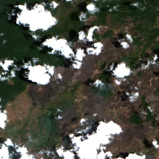
 True view
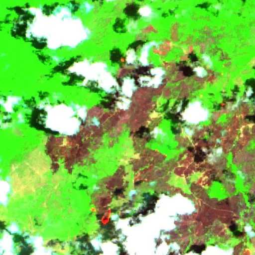
Fire view
Fire view (right): infrared (SWIR), sees through smoke and brings out the heat.
🟢 green = vegetation
🟤 brown = already burned
🟠 orange = fire right now
Drag to compare: normal photo on the left, heat brought out on the right.
Green: vegetationBrown: already burnedOrange: fire right nowSentinel-2 · Copernicus
Red dots: heat detected by satellite in the last 48h. NASA FIRMS
The story so far
About 40 km northeast of Central.
Following a protracted two-week run that defined the tail end of the region's typical fire season, the wildfire near Central, Brazil, has officially ended. Burning for 14 days after starting on October 16, 2026, the blaze left behind an estimated 380 hectares, or roughly 939 acres, according to satellite estimates based on thermal hotspots.
During its campaign, the fire front generated an intense heat signature detected by satellites. The incident unfolded within a broader national landscape that has seen 11,329,346 hectares burned so far in 2026, a figure tracking 63% below the country's two-decade average.
In context
This wildfire burned in Brazil for 2 days. In total it burned about 380 ha (939 acres) — around 3.8 km². That size is an estimate from satellite hotspots, not a measured area.
Close to the tropics, fires tend to follow the dry season and are often linked to land-clearing rather than a single summer peak.
The bigger picture in Brazil
Across Brazil, roughly 12,466,195 hectares have burned so far in 2026 — 60% below the two-decade average. Data from Copernicus GWIS.
Alerts near Central
This fire is over. We'll email you if satellites detect new fire in this area. Free, no account.
Get alerts Brazil todayLive
Community reports
Reports from people near the fire · unverified
Be the first to report what is happening →
Not official emergency information. In an emergency, contact fire services/authorities.
More fires in Brazil
See all Wildfire near Oriximiná (Nov 14)Active · about 430 hectares (estimated)
 Wildfire near Porto de Moz (Nov 14)Active · about 350 hectares (estimated)
 Wildfire near ABC TropicalActive · about 380 hectares (estimated)
 Wildfire near Cutias (Nov 14)Active · about 330 hectares (estimated)
Wildfire near Medicilândia (Nov 14)Active · about 680 hectares (estimated)
Wildfire near Nova Olina do MarnhaoEnded · about 330 hectares (estimated)